| If you do
NOT see the Table of Contents frame to the left of this page, then
Click here to open 'USArmyGermany' frameset |
|||||||||||||||||||||||||||||
|
649th
Engineer Battalion (Topo) |
|||||||||||||||||||||||||||||
|
|
|||||||||||||||||||||||||||||
|
|||||||||||||||||||||||||||||
|
|
|||||||||||||||||||||||||||||
| Battalion History | |||||||||||||||||||||||||||||
 649th Engr Topo Bn (WWII) 649th Engr Topo Bn (WWII) |
|||||||||||||||||||||||||||||
| 1945 | |||||||||||||||||||||||||||||
| (Source: Email from Arthur A. Hart) | |||||||||||||||||||||||||||||
|
In
August, 1945, I was transferred from Easy Company, 275th Infantry
to the 649th Engineer Battalion at Waiblingen-bei-Stuttgart. I had
been classified as "cartographer, skilled," when I took the Army
General Classification test at Fort Lewis, Washington, in July,
1942, and now, more than three years later they discovered there
was a need for my talents!
At Waiblingen we had the task, as I understood it at the time, of sorting and classifying hundreds of thousands of captured German military maps. We were told that our allies would get a copy of each, we'd keep what the U.S. might need, and that all the rest would be destroyed "to inhibit the Germans from making war in the future." We were housed in a very attractive residential neighborhood, where some of us pulled guard duty at night. I remember that once we were trucked into Stuttgart to a theater where an American company performed the play Night Must Fall. I think the actors were all GIs, but it was good show. I spent only a couple of weeks in Waiblingen when three of us were accepted to go to Biarritz American University in the southwest corner of France where we could continue college educations interrupted by the war. On the proverbial "dark and stormy night" we set out for Frankfurt-am-Main to catch a train for Biarritz. We had a driver and a jeep -- open, of course, and despite being wrapped to the eyes in blankets, we got soaked in a long drive on the Autobahn, punctuated by frequent detours around blown bridges. Bill Glaeser and Victor Wigleswoth became good friends and we have kept in touch ever since. We had a wonderful semester in Biarritz in the heart of the French Basque country. In October we returned to the 649th, then stationed at Fontainbleau, Southeast of Paris, awaiting shipment home. My buddies had enough points to go, but I, as a replacement, didn't, so they transferred me to the 1262nd Combat Engineers at Enghien-les-Bains, north of Paris. I boarded a Victory Ship for New York in March (1946), and was discharged at Fort Lewis on Saint Patrick's Day. There isn't a lot of 649th history here, but it is a tiny piece that may connect with the experience of others who were at Waiblingen and Fontainebleau. Arthur A. Hart |
|||||||||||||||||||||||||||||
|
|
|||||||||||||||||||||||||||||
 649th Engr Bn (TOPO) 649th Engr Bn (TOPO) |
|||||||||||||||||||||||||||||
| 1973 | |||||||||||||||||||||||||||||
| (Source: Emaill from Richard "Rick" Losa) | |||||||||||||||||||||||||||||
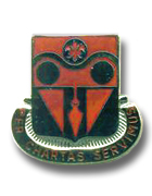
| I was stationed at Tompkins Barracks back in 1973 – 1976. I was a 19 year old kid when I was assigned to the 649th. I worked in one of the M-292 expandable vans we had at the Ramp when I was in A Co. I was a stereo-multiplex compiler at that time, and then I worked on scribing the maps, type formatting and stick up, among other things. I was assigned to Edit when I went to HHC. I never did any Personnel stuff. Chief Maxwell also came up to be our department head. We edited the maps coming out of Repro and the standard FRG maps that we generally disseminated to the rest of the Armed Forces in Europe. When Reforger came around, we really humped on the aerials and made sure all the roadways and training fields were up to specs. ADDITIONAL INFORMATION I can remember the Bn. Commander as LTC Ralph Miles. I do not remember the Bn. XO. The CSM was a fellow named Elm. I worked in what was called A Co. back then down at “the Ramp”. We would have morning formation, take roll and go to work. I worked for CW2 John Maxwell, our PLT SGT was Denny Johnson. We had John Rosean, Tom Gilbert, Ed Whitfield, Al Jedd, Ray Shada, Al Creech, Ron Altenburg, Mike Eddy, CW2 Harold Mazza, SFC John Dodge and other folks whose names are a blur, but remembered sometimes. We had one of the first women officers assigned to the Kaserne, 2LT Annie Hernandez. We also had some of the first women enlisted people in the Kaserne, Renee Starling, Judy Boyle and Susan Kuehn. I went to HHC and they cleaned out Kilbourne Kaserne and moved all of the MILPERCEN folks in there. We suddenly has a lot of American women to talk to! Our mess SGT was a guy named Vigari. My CO at A Co. was Leo Piel, my 1SG was a guy named Tokuhisa. When I went to HHC, the 1SG there was a fellow named Tadakuma. My spelling is probably wrong on half of the names listed, but it is as I remember it. At HHC, there was Ralph Gordon, Dave White, Leroy Cressy, Colleen Mack, Glenn O’Neill, Floyd Wever and others. More names: A Company: Lenard Brown, Jay Van Andel, Kim Frost, Butch Kidd, Frank Childress, Don Kirk, Ken Arey, Roger Burhans, Kelvin Walls HHC: Mike Pearce, Mike Covington, Ernie Arevalo, Justin Tarr, Dave Wilcox My experiences of Germany are mostly memorable. I hated the wet cold rain, but loved the snow! We made maps for Reforger, spent time in the field on FTX’es and worked hard. I left the 649th in February of ’76 and went to college where I remained in the active reserve and continued until retirement in 1999. The Unit crest you show on your web page above the Commanders coin was designed by John ‘Woody’ Woodburn and Paul Balcavage. I have a set in my dresser drawer. If you are in touch with anyone from my era, please let me know. I keep in touch with one of my old beer buddies, Al Creech via Facebook.) |
|||||||||||||||||||||||||||||
| 1975 | |||||||||||||||||||||||||||||
| (Source: Emaill from Al Shimizu) | |||||||||||||||||||||||||||||
| I too had been assigned to the 649th Engr. Bn. With several tours, and many assignments within. My first assignment 1975 to 1978 Names: There were many other names that comes to mind as I continue on with this. The 517th Det. Commander at the time was Maj Hillman, and NCOIC, was SFC Diaz. Cpt.. Nelson learned that I had a vast experience in projects of "City Mapping" and he was the OIC, of a mapping team called "Classified Mapping Facility" (CMF). At the H-Building. That was at USAREUR, Campbell Barracks. |
|||||||||||||||||||||||||||||
| 1985 | |||||||||||||||||||||||||||||
| (Source: Emaill from Al Shimizu) | |||||||||||||||||||||||||||||
My second assignment was from Mar. 1985 to Jul 1990. This assignment was a "Whirl Wind" Had so much different assignment within the 649th. 506th terrain 8th ID... 1985 1987 Had a very great time serving with the 8ID. Was appointed as Commander, as Ed Hugh, PCS'ed, and there were no replacement for him. I even got orders of appointment as Detachment Commander. Than, it was about that period of PCS' s. New commander, Floyd Weaver. Then I got reassigned to 630th Engineer Company, 649th Bn. As NCOIC, production control. There I met. 1sg Heat Stayed there for about a year. Then was TDY to Kornwestheim. With the 7th Corps terrain team as they were in need of an NCOIC. Stayed there for about 3 months (Nov-Jan). Than returned to Tompkins Barracks, as the Battalion's S2. At the time there were no S2, officer, and we were about to undergo our units security inspection, and soon after, our ARTEP. Names@S2 Anthony and I, called her 220. Just because she kept her hair like she had her finger in the 220 socket☺. After S2, I was named to be the 1SG to replace 1SG Heath, at A Co. (Huge Boots to fill) Along with commander, Cpt. Kaycee Carlson. Names There are many more faces in my mind, but can not recall names. Than after a year, (1990) I PCS'ed to Hawaii, Bn Cdr's; These are the only ones comes to mind. I can picture the commander before Osgood, hHe was a very small fellow. |
|||||||||||||||||||||||||||||
|
|||||||||||||||||||||||||||||
| If you have more
information on the history or organization of the 649th Engr Bn (TOPO),
please contact me |
|||||||||||||||||||||||||||||
|
|
|||||||||||||||||||||||||||||
| 517th Engineer Detachment (Terrain Analysis) | |||||||||||||||||||||||||||||
| (Source: Email from John Jens) | |||||||||||||||||||||||||||||
| Just a few things: the current topo – now geospatial – system was stood up on/about 17 July 1979 – that was the day I PCS’d from Germany.
The morning was a quiet sunny day with the Rhein Valley mist still hanging in the air and dew on the parade field behind the Tompkins Barracks kaserne headquarters. I was team leader for the terrain analysis team which supported V Corps, as part of the 517th Engineer Detachment (Terrain). The 517th reactivated to support V Corps & then 526th was activated to support VII Corps & other numbered smaller units were activated to support the divisions and the carto companies to support the corps. Before the July 1979 date, the detachment was in general support to the theatre, much as the battalion was a theatre level asset. With the post Viet Nam renewed interest in terrain analysis, we got more visibility by task organizing and actually going out & supporting the corps & divisions in their FTX's & CPX's - one officer, an NCO, & a handful of soldiers. |
|||||||||||||||||||||||||||||
| (Source: Email from Brian W. Haren, 517th Engr Det, 1983-85) | |||||||||||||||||||||||||||||
Hello again (I'm the guy who identified the strange antenna atop the I.G. Farben building a few weeks ago - Mystery Photo #7).
Anyway, I managed to find your page concerning the 649th Engineer Battalion (Topo) under the 18th Engineer Brigade. I commanded one of the listed units, the 517th Engineer Detachment, from 1983 to 1985 and was with the unit when it restationed from Thompkins Barracks in Schwetzingen (near Heidelberg) to Frankfurt. The early 1980's were a time of big shifts in USAREUR as the command was moving units around within theater to better focus combat power. Our restationing was done so we could co-locate with our supported headquarters at V Corps. Although we remained part of the 649th Engineer Battalion, in Frankfurt we supported the V Corps G2 and were attached to the Corps MI Battalion.
Our job was to provide terrain analysis (military geography) support and we focused on vehicle trafficability studies and transportation studies of the Fulda Gap and the Hunfeld-Schlitz-Lauterbach approach into West Germany. It was fascinating work and I had some truly great soldiers working for me, many of whom I've remained friends with down throught the years. The 649th was a great unit, and an unheralded one. The battalion was a 'full service' topographic unit that provided topographic and geodetic surveying, map compilation, map printing, map distribution and terrain analysis support to V & VII Corps, USAREUR HQ and EUCOM. We were the only US unit of it's type in Europe and we stayed very, very busy.
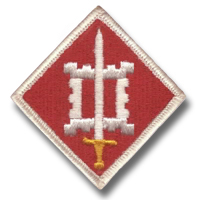
(BTW, the 18th Engineer Brigade shoulder patch you show on the page is upside down. The sword should be pointing up, not down. (Webmaster Note: The error has been corrected!) |
|||||||||||||||||||||||||||||
| 526th Engineer Detachment (Terrain Analysis) | |||||||||||||||||||||||||||||
| (Source: Email from Jeff Chriss) | |||||||||||||||||||||||||||||
| Interesting info on the 649th Engineer Battalion. We had a Chief Warrant Officer, a Second Lieutenant, another Staff Sergeant, and a couple of other Sergeants and Privates, but I don’t remember their names either. Our unit worked out of the basement of one of the old German Army barracks. We had a couple of SCIF’s with bank vault type doors we locked at night and jail type bars we used during work hours. Combination locks were used for all doors in the facility. Our major efforts included creating map overlays for We probably had over 20,000 maps on site and access to whatever else we needed through the 649th. In mid-1986 we got our first computerized mapping system. It consisted of an IBM machine with a 12 inch laser disk for reading digitized maps. It was hi-tech at the time but today’s hand held GPS units have more power and information than our unit had. The laser disk would take about 2 minutes to go from one scale to another and the digitized info was very limited. The system was for reading information only it did not have the capability to modify or store information. If we had access to Google Earth back then we would have been the classified Super Top Secret. A lot of time has passed since then but we still have fond memories of being in ADDITIONAL INFORMATION My wife and I talked and remembered a couple of the missing names serving during our time of duty. SPC Dave Dolifka We are going to look around and see if we can find some pictures. |
|||||||||||||||||||||||||||||
| MILCOM Newspaper Articles | |||||||||||||||||||||||||||||
 |
|||||||||||||||||||||||||||||
| 649th Engineer Battalion - Mapping the way for USAREUR units, By Ken Blackburn, April 2, 1987 | |||||||||||||||||||||||||||||
|
|||||||||||||||||||||||||||||
|
|
|||||||||||||||||||||||||||||
| Engineers
manage maps averaging 500,000 monthly for USAREUR missions By Neil Taylor II 24th Eng. Plt., June 26, 1987 |
|||||||||||||||||||||||||||||
| Have you ever
wondered what class of supply maps is? Have you ever tried to guess
how a map is made, upgraded, revised, or reproduced? Better yet, have
you ever asked yourself who stocks the vast quantities of maps to
support the European Theater? First, a map is a class Ila item. Second, maps are no longer made by the Army, but they are upgraded and reproduced quite extensively by the assets assigned to the 649th Engineer Battalion. Third, after they are reproduced, they eventually end up at the doors and on the shelves of the USAREUR MAP DEPOT (UMD), for stockage and distribution. The UMD is operated by the 24th Engineer Platoon in conjunction with an augmented TDA, The Theater Topographic Map Inventory Control Point (TTMICP). As engineers, not much unlike the combat arms, we have a definite need for maps in whatever operation we are involved in. Acquiring the required quantities of maps in a timely manner is important as well as ensuring the products are up to date. To use a map that is outdated can be most disastrous in any operation as any engineer can attest. The distinct mission of acquiring, stocking, and distributing the latest up to date maps to all Army units stationed in Europe has been delegated to those quartermaster soldiers assigned to the 649th Engineer Battalion. The 24th Platoon is assisted to get the units of the V and VII Corps their maps by the two corps cartographic company's map distribution platoons. Therefore, the UMD is in genera support of the V and VII Corps but is in direct support of all non-corps Army units. The depot currently is required to stock approximately 20,000 separate map sheets consisting of approximately 45,000,000 maps or map related products of various sizes, shapes and scales. This quantity increases whenever support is required for special exercises such as REFORGER. As a matter of fact, the upcoming REFORGER exercise has increased the stockage by approximately 2,000,000 maps. The larger quantity mentioned above is spread out and stocked in one of nine separate stockage sites. The 24th maintains three theater war reserve sites, a war contingency site, three classified vaults, an operational stock area for those never-ending daily requisitions that must be filled and, the USAREUR Map Library. All this labor intensive management is done with a MTOE presently at full strength of 35 personnel augmented with a TDA of five personnel, including three civilians. On an average the depot distributes approximately 500,000 maps a month. Whenever there is a major exercise, this amount usually triples. Although the unit does issue the majority of the maps to a needy customer, it must dispose of outdated maps once replacements have arrived. The priority for new editions is to issue them to units that require those particular map sheets as part of their basic load. All units require a basic load, and each unit should have enrolled in the Automatic Initial Distribution System (AIDS). This system tells which unit requires which map sheet and the quantities needed. Once a revised map sheet has arrived in the UMD and is processed, it is automatically sent out expeditiously to update the customer's basic load. The UMD and the soldiers of the 24th in this regard have a daily real world mission akin to the postal soldiers. These map products must get to their destination in a timely manner. To ensure this quality of service there are soldiers to assist customers in developing basic loads. They also assist in getting customers enrolled in AIDS, ordering maps, and tracking down requisitions through the complex maze. Don't hesitate to call for assistance, the phone number is: 379-7617/6258 or write to, Commander, 24th Engineer Platoon, 649th Engineer Battalion (T), APO NY 09081. |
|||||||||||||||||||||||||||||
|
|
|||||||||||||||||||||||||||||